«Before erecting the menhir [
], man had a symbolic way in which to transform the landscape. This way was walking» (1) Then came the bicycle, curiously together with the first cinematographic experiments and equally linked to the circular movement of a pair of wheels
This may be the reason why Luigi Vittorio Bertarelli begins his journal on a bicycle with unexpected comparisons between the description of a landscape which passes by in the eyes of a cyclist and cinema?
«Thirty six hours on an express train bring me in the blink of an eye from Milan to Reggio Calabria [1,400 k of railway, editor's note]; I get off, unpack my bike. » [
] «And I immediately leave again. It is nine o'clock in the morning. Filming five days of excursions in a new landscape is a very big challenge. In the background the ever renewing of the land I sketch out the people and things that are moving and also my own being which is in my opinion the protagonist in the scene. My aim is to avoid creating a cold and static image but instead an animated picture flowing in front of me; this is something that I will probably not be able to do and that in the end will give the same stifling impression of the cinematograph. Maybe you will say in the end: how true that is! Therefore it has a purpose even in cycle tourism? Hence I turn on the light, project the circle of light on the screen and the device begins to turn... and I start.» [
] «The cinematograph turns and gives me no rest.» (2)
It is 1897, Luigi Vittorio Bertarelli merchant, brother of Achille, collector of prints that have now become the Civica Raccolta Bertarelli (Bertarelli's Civic Collection) an enthusiastic cyclist, begins keeping a very detailed note book of his cycling excursions. His journal is already a political manifesto from its Introduction: «I write for you cyclists who are used to real tourism as much as you are used to your muscles. [
] I also write for you, people who have a phobia of bicycles, counselors and mayors: my words make you scowl, you will find yourselves in a moral world that is totally new to you and a little incomprehensible, but maybe this will be the sting that will deflate the tyres of your preconceptions?»
Italy has just been reunified and the patrols of the 35 year old co-founder (1894) of the Italian Touring Club begin in those regions that are the furthest away from Milan, where he lives: Calabria, Basilicata, Sicily, Aeolian Islands and Sardinia. His notes are not only a story of surprising social interest, but they also represent the first evaluation of transport links, a definite starting point to openly sustain the necessity of road maintenance as a way to take care of an Italy that needs to write its history and needs to be imagined. It also needs to be invented, around a means of transportation such as the bicycle that integrates with the railway and allows to explore with a more intense spirit of reportage; looking around, meeting people and maintaining the body very close to the well-trodden soil of the streets.
Zooming back from Bertarelli's handle bars to observe him in a more abstract space, one can note in the man a behaviour that evokes periods and predispositions that are far away from each other: homo ludens and homo faber (3) that are problematically unified in the unsolvable contradiction of modern man. Bertarelli knows he is not a discoverer, but someone that can suggest a different way to travel the world with the aim to discover it, and he writes: «I am an artist polluted by the positive spirit of the world and while I admire so much beauty I take in inspirations and practical suggestions. Hence I write».
|
|
His pragmatic and idealistic vision is very well represented in the peculiarity of its editorial product: short copies, precise notes and the doubling up of the way to visually describe a path with a planimetry and an outline which acquires new dignity and becomes an itinerary.
The visible look that flows on the wheels and also the representation of a wide-reaching look, from above and from the map, come together in the pages of Profili ciclistici [see pictures]. The result is a territory made of sections and horizons, of cut shapes, on which one cannot wonder as it is normally done on world maps or atlases. A world that is neat, limited and accessible. In other words, an outlined world, a pocket guide for travellers on two wheels.
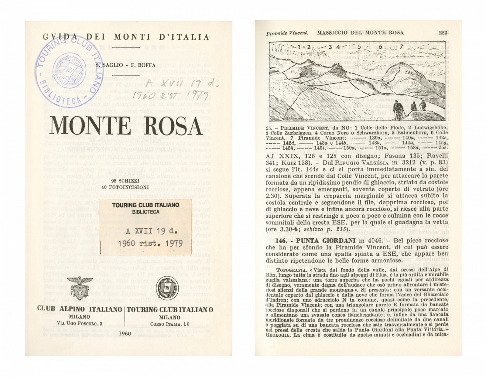
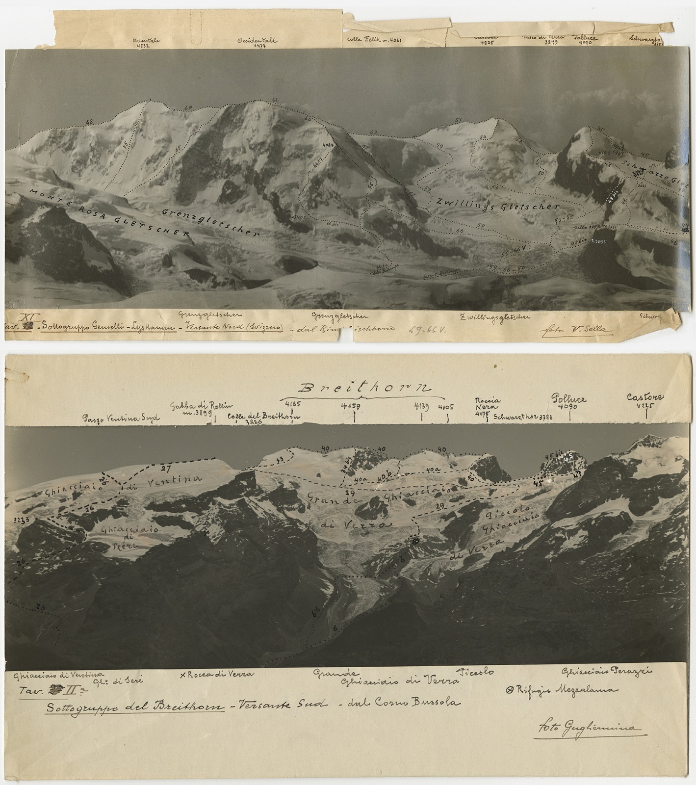
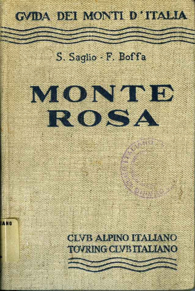
A similar brief and synthetic approach will be used a few years later in the Guide dei Monti (Guide to the Mountains) with the addition of a heavily retouched photographic means that is used as a real drawing of the horizons. The integration between medium is freely used by the Touring to give precise references to the readers: pictures of different authors from which one can obtain noted outlines of the slopes of mountain chains, from which one could acquire graphic support when drawing precise paths. This synthetic vision obtained through different descriptive means (word, drawing, photography and graphics) turn these publications into examples of narrative of the landscape through the reinvention of the topographic description. It is not random in fact that the Touring invented the Italian road signs system and represented it in the long process of the European standardisation...
Of course, if one looks at it with a contemporary eye, the shape of the outline, in topography and portraits, has something defined and fixed. It separates the figure from the background. This is a shape that in maps tends to remain more similar to itself than anything else, unless calamities happen transforming the landscape. It is a shape suitable to represent the limits and not suitable to show those ambiguous and interactive borders with which those new «geography of resilience» (4) and of impermanence that look for the comparison of uncertainty and flexibility with floods, tsunamis, landslides and similar twisting of the landscape. This is only a symptom of how much geography itself is a narration that can and has to shape its language with the period it is narrating.
A special thanks for the collaboration goes to Centro Documentazione TCI, the Digitouring Online Archives, Luciana Senna and Ilaria Parma.
[ Laura Marcolini ]
--------------------------------------------
(1) - Extract freely translated from Francesco Careri, Walkscapes, camminare come pratica estetica, Einaudi, Turin 2006.
(2) - Extract freely translated from Luigi Vittorio Bertarelli, Insoliti viaggi. Lappassionante diario di un precursore, Italian Touring Club 2004.
www.touringclub.com/libro/insoliti-viaggi.aspx.
(3) - Francesco Careri, on Cain and Abel, shepherd and farmer/harvester, homo faber and homo ludens.
(4) - Pierluigi Nicolin, Le proprietà della resilienza, in LOTUS, Geography in motion, September 2014, Milan.
|
 home
cover ▼
opinions
news ▼
portfolio
post.it
post.cast
video
ongoing
thematicpaths
googlecards
FPtag
home
cover ▼
opinions
news ▼
portfolio
post.it
post.cast
video
ongoing
thematicpaths
googlecards
FPtag
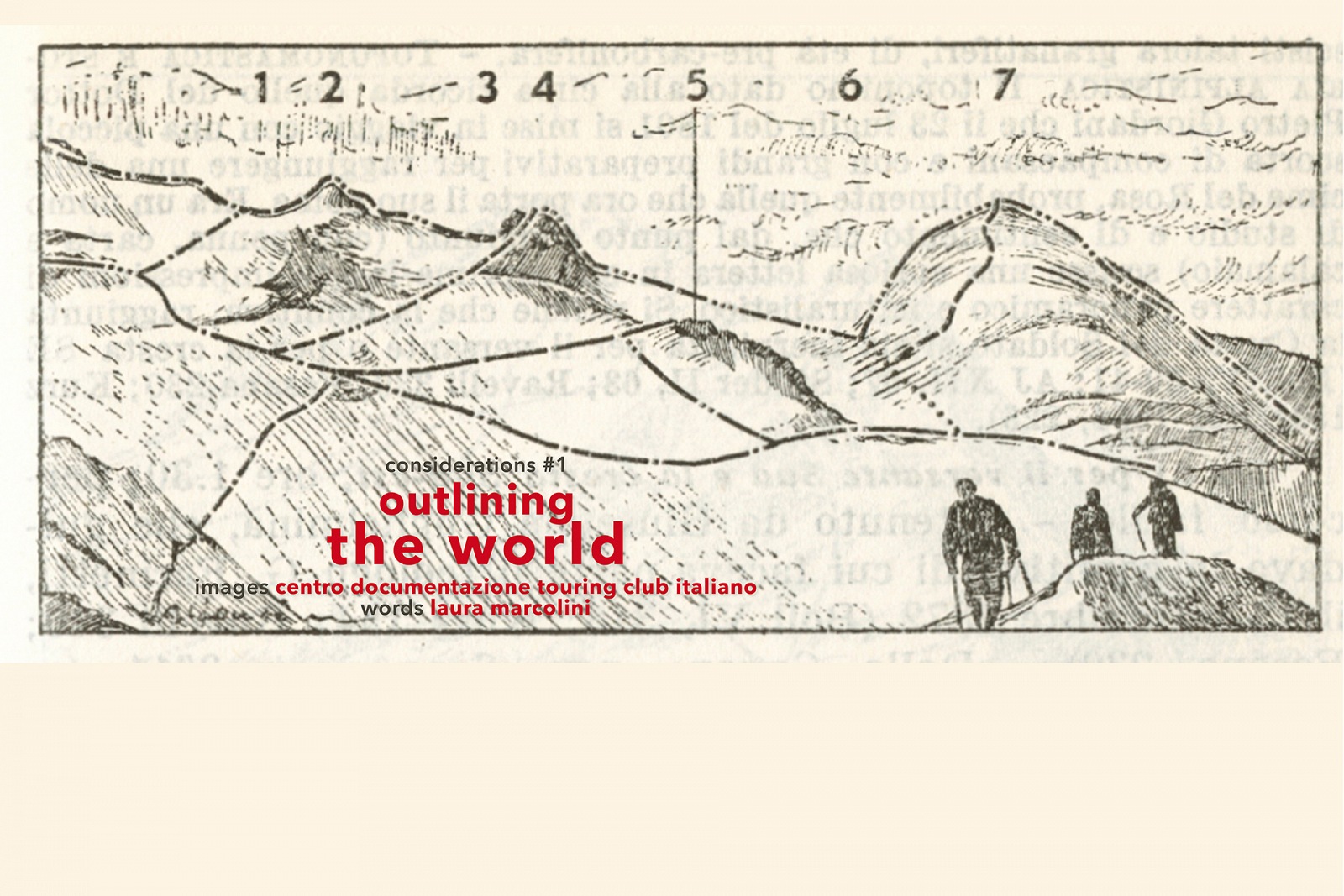


 Touring Club Italiano - Since 1894 this association has silently mapped an entire Country several times with its constant editorial activity and its ability to incite very efficient forms of participation and with different instruments, inventing and strengthening languages; firstly through geographical maps and atlases, then with graphics and road signs, then with the Guide Rosse (a century old this year), and lately with photographic campaigns. Through all these different ways, it has continued to transform routes into itineraries, in other words into paths along which one can pause to observe and absorb the landscape in all its forms.